
From: casarollnotes.blogspot.com
Tim and Linda Bunyan
Travel Tour 2020 - The "Rock Stars" of Moab
Travel Tour 2020 - The "Rock Stars" of Moab
We have come from Delta, Utah to another small population (2,500) town of Salina, Utah.
We are driving our way to Moab and using this week to view small-town living in Sevier County.
We arrive at our Membership RV Park: Butch Cassidy RV Park (no charge) I am happy to find the Laundry room is open. The pool is closed. So I can do laundry but no swimming.

 1865 Mormons came and made claim, through toil and infrastructure development, and constant, the diligent effort of agriculture. They found abundant salt deposits nearby so they named the area "Salina". Coal was discovered and in 1908 the area was being fully cultivated.
 Salina is at the northern edge of an extensive ATV trail that covers the southern portion of Utah, the Paiute Trail. We noticed many, many trucks hauling ATV's

 Many enthusiasts!


The Hot Spot (referred to us by my hairdresser). Hamburger drive-thru with outdoor picnic tables. Tammy Jensen Harrison, 3x State Champion, Utah State High Jump,
the record holder is the owner of the Hot Spot on Main Street.
 Here are a couple young boys having lunch together at the side yard of the Hot Spot. On their own, having young boy conversations with each other; caught my attention for a photo moment.
 Across the street from the Hot Spot is the Burns Saddlery; it is open by appointment only. I peeked inside through the window and there were saddles, spurs, and cowboy hats on display for purchase.

Sites around town; the local LDS church.
 A nice home in the neighborhood. Decorated in Red, White, and Blue.
 This other house decorated with the TRUMP logo and signs.
 Downtown on Main Street, the State Liquor Agency office.
 Mom's Cafe on the Main Street intersection.

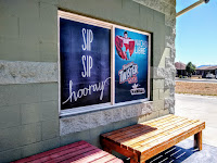
We had to go for a soda drink at this unassuming, popular drive-thru named: The Soda Run.
They just sell sodas! Angela guessed correctly, Tim and I ordered the Orange Creamsicle - Orange Twister, Pina Colada, Vanilla Cream. Alicia (on Facebook) chose her fav: the Kenzie Special - 7up, Cream side, Vanilla Cream.



Tim took this picture of all the color at the nail salon. He did get a pedicure, but no color.

The Visitor Center and Welcome to 'the city' Richfield (population 5,000)

The hair salon station and stylist Cheyanne. She grew up a cowgirl, roping and riding. She met her husband in the same arena.
 This is the waiting room in the hair salon. I am so taken with the style of this salon. It is a converted house in the neighborhood.
 The Visitor Center entrance to the parking lot is blocked: closed.

The Salina Veterans Memorial Park 
This is a working area. There are plenty of truck haulers and trucks. Ad for Kenworth and Freightliner...alot of that here.

 Laundry is done and the refrigerator is full. We are going into the Moab area, Canyonland National Park, and Arches National Park. Our first camp is at Dead Horse Point State Park, staying nearly 15 days. We may not have a strong cell connection. The town of Moab is about 35 miles from our first camp.
Mike and Sherry are meeting us there tomorrow. Ron and Frannie are coming to their new rig next week. Kevin and Gordon Hubble and Skip and Linda Garrett are joining us too! Gordon and Kevin are bringing their 4-wheel drive Jeep, so we anticipate a rootin, hooting, hollering adventure.
We are driving our way to Moab and using this week to view small-town living in Sevier County.
We arrive at our Membership RV Park: Butch Cassidy RV Park (no charge) I am happy to find the Laundry room is open. The pool is closed. So I can do laundry but no swimming.


This is a unique trailer for towing bikes.

The Hot Spot (referred to us by my hairdresser). Hamburger drive-thru with outdoor picnic tables. Tammy Jensen Harrison, 3x State Champion, Utah State High Jump,
the record holder is the owner of the Hot Spot on Main Street.


Sites around town; the local LDS church.


They just sell sodas! Angela guessed correctly, Tim and I ordered the Orange Creamsicle - Orange Twister, Pina Colada, Vanilla Cream. Alicia (on Facebook) chose her fav: the Kenzie Special - 7up, Cream side, Vanilla Cream.


There were no beauty salons in Salina, so Tim and I drove 15 miles to 'the city' of Richfield (population 5,000) for the day. (There is a Walmart there too, so we stocked the refrigerator for our "Rock Stars" in Moab adventure.)
This house is "The Works" nail and hair salon.
T
This sign inside the salon, written by one of my fav authors: F. Scott Fitzerald.

Tim took this picture of all the color at the nail salon. He did get a pedicure, but no color.

The Visitor Center and Welcome to 'the city' Richfield (population 5,000)

The hair salon station and stylist Cheyanne. She grew up a cowgirl, roping and riding. She met her husband in the same arena.


This is a working area. There are plenty of truck haulers and trucks. Ad for Kenworth and Freightliner...alot of that here.


Mike and Sherry are meeting us there tomorrow. Ron and Frannie are coming to their new rig next week. Kevin and Gordon Hubble and Skip and Linda Garrett are joining us too! Gordon and Kevin are bringing their 4-wheel drive Jeep, so we anticipate a rootin, hooting, hollering adventure.




